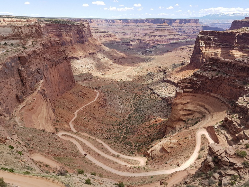
The rugged terrain around Moab—cut by rivers, sheer rock faces, and steep inclines—wasn’t always as accessible as it is now. The dirt roads and singletrack trails that, today, invite outdoor enthusiasts to explore the area’s cliffs and canyons and admire the red rock towers and buttes, once served the ranching and mining industries that drove the local economy before tourism replaced them. Some of the most popular access roads for recreation—for example, the Mineral Bottom Road—owe their existence to those former industries.
“There was a lot of uranium mining down that road,” said David Vaughn, a longtime local who worked for the Grand County Road Department for 17 years. “There was even an old mill.”
Concrete foundations are all that’s left of the mill near Mineral Bottom, but the whole area is still perforated with old mines. In the spring of 2021, the Bureau of Land Management partnered with the state’s Abandoned Mine Reclamation Program to safeguard 29 abandoned mine openings in the Mineral Canyon area.
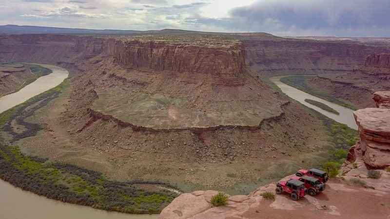
Today travelers on the Mineral Bottom Road are usually on bikes, embarking on a backcountry drive, or at the beginning or end of a trip on the Green River. The road branches off of Highway 313, the same highway that leads to the Island in the Sky District of Canyonlands National Park and to Deadhorse Point State Park, popular sightseeing destinations. On the way to the parks, 313 traveses a mesa top that looks down over the Green River on its west side and to the Colorado River on the east; the confluence of the rivers is visible from the mesa’s southern tip. Today, the area is crisscrossed with Jeep routes and single-track trails; it’s also still dotted with mines and traces of prospecting days.
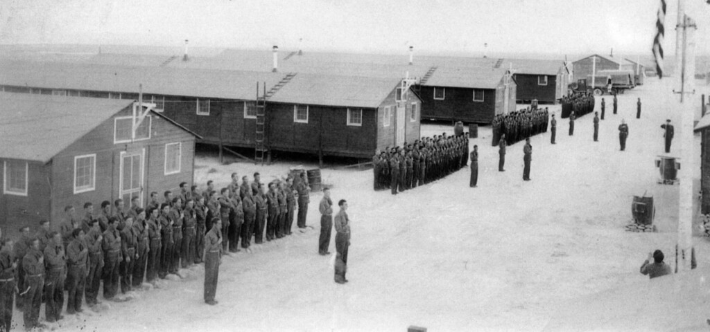
A 1953 document archived in the Utah Geological Survey’s Historical Uranium and Vanadium Publication Collection (available online), records the findings of U.S. Atomic Energy Commission agent Paul deVergie on review of loan requests from the Excalibur Uranium Corporation. According to the document, Excalibur had 330 claims on both sides of the Green River and 100 claims in Hell Roaring Canyon, which is just north of Mineral Canyon. A previous loan from the Defense Minerals Exploration Administration had funded construction of a road in Spring Canyon, the next major canyon north of Hell Roaring; the corporation was looking for another loan to build a road in Hell Roaring.
In the 1950s, the AEC had broad control over the uranium industry, and the U.S. government was eager to develop the material both for weapons and energy. Granting loans to build roads in promising areas was just one way the agency could encourage production of uranium.
“It is strongly recommended that a rough access road be put up at least 4 miles into Hell Roaring Canyon,” the document advises.
Mining roads overlapped through the decades with new and old roads established to move cattle or for oil and gas exploration and extraction. Vaughn got to know backcountry roads in Grand County particularly well when he participated in mapping them for a state project inventorying rights-of-way. Vaughn and a team of others took GPS data on thousands of miles of roads in the county.
“Mineral Bottom really impressed me because it was so rugged out there, and narrow and steep,” Vaughn said. “Spring Canyon was the same way—you look over the side of the road and look 600 feet down—it’s kinda scary sometimes.”
Those extraordinary roads that allowed for mining exploration and operations became a vital artery for the tourism economy. In 2010, flooding washed out huge sections of the Mineral Bottom road, meaning boat and bike shuttling companies had to find alternative routes—for example, down Spring Canyon. A 2010 Salt Lake Tribune article from the time says the county and the BLM applied for emergency funding from the Federal Highway Administration to repair the road, because it was so important to the local economy.
After that, sections of the Mineral Bottom road were hardened, with tight switchback bends paved in concrete. Still, the route is susceptible to the tough conditions of the region. This fall, another flood washed the road out again. It’s still a vital artery for outdoor recreators: dozens of boaters on the Green River were temporarily stranded at the Mineral Bottom boat take out until Search and Rescue personnel were able to transport them out. Technology and the economy have evolved, but it’s still rough country in Southeast Utah.
RELATED CONTENT
Moab, Utah: Uranium Boom Led to One of the Most Vibrant Towns in Utah
The Evolution of Main Street in Moab, Utah
Abbey’s Road: Southern Utah Environmentalism
Blue John Canyon — Ralston’s Rock Found

SUPPORT LOCAL JOURNALISM AND SUBSCRIBE TO PRINT MAGAZINE
Subscribe to Utah Stories weekly newsletter and get our stories directly to your inbox