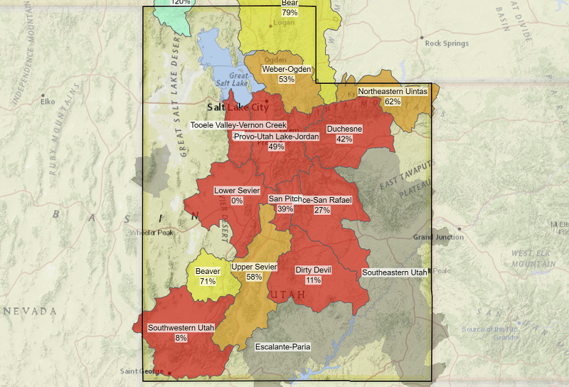
Despite the recent recurring rains we have had along the Wasatch Front, in the month of April and early May, Utah is not even close to being in the clear in the midst of our twenty-year megadrought. Examining the snowpack totals in Utah’s various drainage basins we can see the extent of the problem.
In the Duchesne basin, below the Uintas we are just 54% of normal. In the Provo-Utah Lake basin, we are also at just 54% of normal. Northeastern Uintas, which impacts Lake Powell we are just 40% of normal.
The only river drainage basins that we could say are doing okay are further North. The Bear basin, which feeds Bear Lake, and the Raft basin, which partially feeds the Great Salt Lake, are looking better than most. Bear is at 81% and Raft is at 107%.
The picture becomes bleaker the further south you travel. Escalante and Southwestern Utah are both just barely showing any remaining snowpack. But when we examine the reservoirs the snow totals appear a little better. Jordanelle Reservoir is at 52% capacity. Deer Creek Reservoir is at 86.7% capacity.
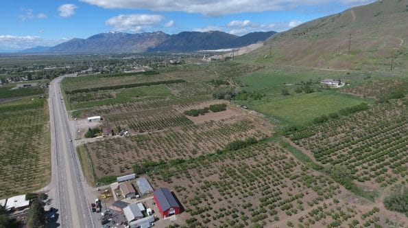
Examining reservoirs in Weber County we can see Causey Reservoir is at 100.5% capacity. But downstream at Pineview Reservoir, we are looking at just 57% capacity, which is better than they were at last year, but still far below total capacity. Nevertheless, this is great news for farmers along the fruit highway. It’s not looking right now like they will be seeing orders to slow their flow, which would impact our peach, apricot, and berries at the farmers markets.

Examining the overall capacity levels of reservoirs we can see the impact that these showers have had since October and it is significant. In October Pineview was below 20% capacity and today we see it at almost 60%. Consequently, nearly every reservoir in Utah shows a similar trend with exception of Flaming Gorge Reservoir. This reservoir is different because it is used to help our neighbors downstream at Lake Powell and even Lake Meade. Since its capacity of 84%, it has been going steadily down sending more water down to Powell.
The Most Severely Impacted Areas in Utah Due to the Megadrought
The severity of the megadrought is the most pronounced when examining the level of Lake Powell. It’s currently at just 24% capacity and according to the water.Utah.gov chart, there has not been any improvement at all from the runoff this year so far. We are seeing only further declines in water levels. Likely Powell’s level will increase as more water is diverted downstream Colorado from upper Colorado, Uinta, and Escalante drainage basins.
The worst part of the drought this year is found in the south-eastern part of Utah, which is in extreme drought conditions. This means Powell will rely further on what little it can use of the Colorado River drainage it receives from the Yampa, White, Duchesne, and San Rafael rivers.
It is surprising to learn that most of Utah except for Washington County (Saint George) relies very little on the waters of the Colorado and Green Rivers. Nevada, Arizona, and California rely far more on this water than Utah. Those states will be impacted the most by the megadrought conditions, as they are all undergoing watering restrictions and California is already facing wildfire and drought conditions.
Stay tuned with Utah Stories all season as we continue to track the conditions of our streams, rivers, and lakes and report to you how the Megadrought is impacting our Great Salt Lake and other major waterways.
RELATED CONTENT
Trouble in Paradise: Ogden Valley Considers Its Water Use Future
Water In The West: Should We Demolish Glen Canyon Dam?
The Battle Over Utah’s Environment: Great Salt Lake Great No Longer?
Will Utah Have Enough Water to Sustain Its Booming Population?


