Several years ago, I was at a conference for professional city planners. A speaker asked for a raise of hands to the question, “How many of you walked to school as a kid?” Nearly every hand in the room went up. Then they asked, “How many of your children walk to school now?”Only a handful of arms were raised — probably less than one in twenty. Certainly there were some in the room who didn’t have kids. I had two children at the time, though young enough they weren’t yet going to school. But it was one of those watershed moments in my professional development as an architect and city planner where I realized how our cities have changed in the three decades since my own childhood.
I thought of the quote attributed to Winston Churchill: “We shape our buildings and afterwards our buildings shape us.” Certainly, the same concept has been at work in our cities over many decades, especially our rapidly growing suburbs, and not with great outcomes. Commuting fatigue and road rage, physical and mental health, feelings of isolation, lack of meaningful social connection and growing lack of civility — all of these challenges in society today have a direct connection to planning and designing cities around cars rather than for people.
Most of us have been to places that are comfortable to walk around. These tend to be places that were built before automobiles were the dominant form of transportation.
In Utah, we find these places in the main streets of older historic cities and towns, from Tooele to Vernal, and from Logan to Moab. Many of our larger cities — Ogden, Salt Lake, Provo, Brigham City, Park City, and Cedar City, to name a few — have even larger historic city centers and adjacent neighborhoods that are compact and walkable. But the impacts of cars and traffic have certainly made them feel less walkable and safe than they once were.
In these places we observe patterns of connected streets and sidewalks. Commercial streets have narrow building lots with tight-knit facades oriented toward the street, and transparent storefronts permeated by frequent entries. Residential streets have landscaped yards, some with minimal setbacks, and front porches and stoops. Parking lots and garages, if they even exist at all, are at the rear and typically accessed from a side yard, alley, or narrow driveway.
As we look at many of our more recent suburban business districts, office parks, and cul-de-sac neighborhoods, it is easy to connect the dots. These late 20th century patterns of development — separated uses, large commercial and residential lots with structures isolated from streets and from other structures by immense parking lots and turf lawns — are no longer conducive to walking. These are primary reasons why so many kids no longer walk to school. And for that matter, why so many people in Utah and the US hardly walk anywhere anymore.
Back in 2010, Ellen Dunham-Jones, Director of the Urban Design Program at the Georgia Tech School of Architecture, gave a provocative TED Talk on the theme of “Retrofitting Suburbia,” following the recent publication of her book by the same title.
There is fortunately some work happening in Utah around these ideas to re-imagine suburbs, revitalizing historically walkable places that became more suburban, and reinventing other more suburban places. Here are some notable examples:
Daybreak Town Center
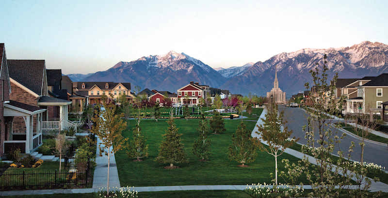
Daybreak has been entirely built on the premise that suburbs don’t have to be so … well, suburban. It is one of Utah’s largest planned developments, over 4,000 acres, with carefully curated oversight from planners and designers who understand the principles of walkable communities.
Highlights of Daybreak’s community character include a walkable and connected street network, well placed community and commercial activity centers with outstanding bicycle and pedestrian infrastructure, a mixed-use business center that is distinctively modern in its architecture while incorporating many pedestrian-friendly design principles from traditional main streets, homes that place a porch rather than a garage door facing the front, and all tied into great regional transit and trail connections that allow people to leave their car behind for some daily activities.

Park City Downtown
Park City already has one of Utah’s most picturesque main streets. City planners have been able to successfully expand the business district while incorporating many design elements and themes that carry the character of Main Street into surrounding areas of redevelopment. And much of the new growth is more dense and more mixed-use than the historic Main Street.
Park City has the unusual benefit of being an international, world class winter sports playground that draws people from far and near, many of whom arrive without their own car and are accustomed to walking, using transit, and using a mobile app to check out a bike or hail a ride-share. Park City’s residential growth is distinctively hospitality focused, but has invested its hospitality revenue into ubiquitous pedestrian and bicycle enhancements that also greatly benefit locals. And programming and promotion have successfully expanded past primarily wintertime hustle and bustle into a walkable city that is active all year.
Holladay Town Center
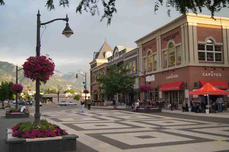
Holladay has pivoted from a mid-century, car-centric village into the increasingly vibrant and walkable Holladay Town Center. Although earlier plans to incorporate more housing into the Town Center mix were scrapped in favor of a commercial-only district, which would have brought a 24-hour, walking-oriented population base into the Town Center, there remain many infill opportunities to address this oversight — especially as empty nesters and thousands of kids leaving the nest throughout Holladay are looking for expanded housing options in a place they already love.
The nearby former Cottonwood Mall suburban shopping center has hit many obstacles in its suburban retrofit, from the Great Recession to a citizen-led ballot initiative to scale back housing density. There is still hope that this major redevelopment will continue Holladay’s walkable center initiatives to date, once the community settles on an acceptable density and fully comprehends the market demand to meet its own housing needs. A family-friendly community with lots of kids needs family-friendly housing choices for every stage of life.
Salt Lake Central 9th District
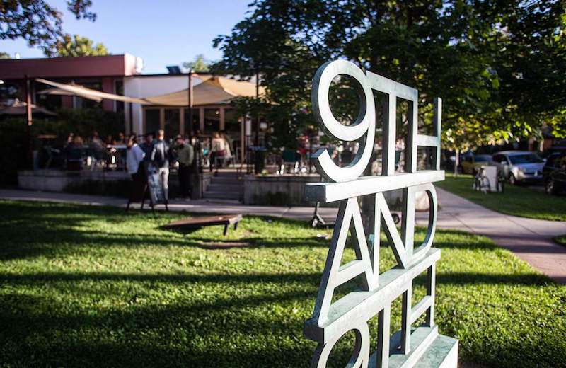
Central 9th is a small, emerging walkable urban neighborhood in an area that is transforming from an industrial edge district of Salt Lake’s city center. While the district has a connected street network, and homeowners have been gradually investing and improving historic houses interspersed with occasional modern infills back into charming neighborhoods, the area is still ringed by large industries and warehouses that are not pedestrian friendly.
Salt Lake City invested in a new 900 South light rail station in 2005, which connects this district by light rail to every area of the Salt Lake Valley. The City also implemented its first Form Based Code in this district in 2012, a policy change that more fully embraces walkable community development with character. Ongoing improvements to bicycle and pedestrian infrastructure, active redevelopment of large infill and sometimes experimental housing such as micro-units with no off-street parking, community activity centers such as SpyHop, and burgeoning incubation of new shops, restaurants and bars, are producing a truly 24-hour, walkable urban neighborhood.
The 900 South viaduct remains a barrier, which old and new residents would very much like to see removed and replaced with infill that reconnects the Central 9th and Ballpark neighborhoods with much needed green space, and new housing and employment opportunities.
Sugar House
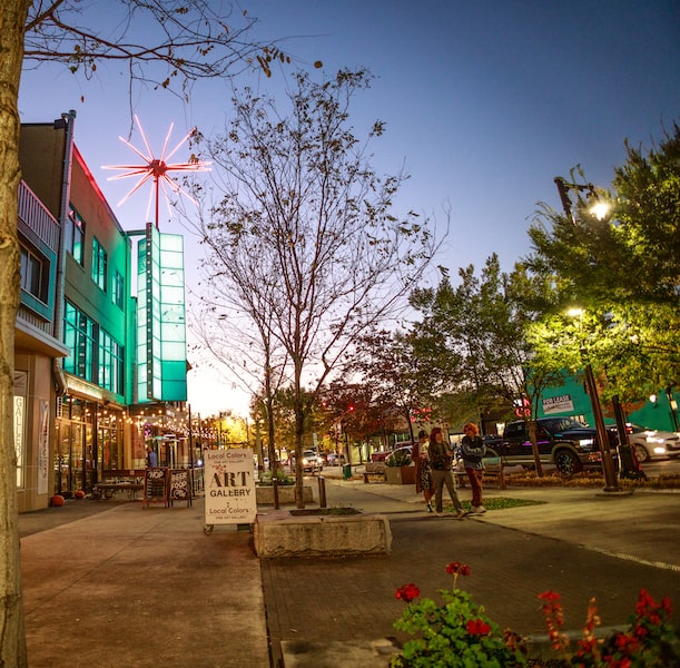
Sugar House emerged in the early 1900s in Salt Lake City as the first major employment and commercial center outside of downtown. Streetcars were a catalyst for historic suburbs like Fairmont and Highland Park, which unlike today’s suburbs, were very walkable. Early development of Salt Lake’s redevelopment policies in the 1980s wiped away declining historic neighborhoods, impacted by the development of Interstate 80 two decades prior, and produced entirely auto-oriented shopping centers like the one that until recently was the home of ShopKo and ToysRUs.
The community pushed back on the suburbanization of Sugar House, and those previous suburban transformations are now giving way to a more walkable, urban neighborhood. A 2005 Sugar House Master Plan recommended policies that emphasized a pedestrian and bicycle oriented community over car-centric development.
Major investments in parks and open space, including Sugar House Monument Plaza, Fairmont Park and Sugar House Park, and improved regional transit systems like the S-Line Streetcar and enhanced bus service (higher frequency service with service extended earlier and later in the day), together with the ongoing development of regional trails such as Parley’s Trail and the McClelland Canal Trail, provide critical regional connections without the need for a car.
While the City has been slow to invest in pedestrian and bicycle infrastructure within the heart of Sugar House, recently proposed makeovers to McClelland Street, 2100 South, Highland Drive, 1100 East, 1300 East, and 900 East (now in process) will bring long-awaited, local pedestrian and bicycle enhancements that will finally support the infill housing and mixed-use urban development that has been robust over the last decade.
Such transformations are encouraging.
If you would like to see more retrofitting of your own suburbia, Envision Utah recently published “Creating Communities: A Guide to Walkable Centers” in 2021. This resource for policy makers, planners, designers and engineers contains examples of transformative work to re-imagine and retrofit suburbs around Utah. Its useful definitions, talking points, guidelines and case studies provide a timely “how to” tool kit.
RELATED CONTENT
Why Most Utahns No Longer Walk
Living Without Cars in Moab, Utah
Healthy Cities, Healthy People
Subscribe to Utah Stories weekly newsletter and get our stories directly to your inbox

