SALT LAKE CITY — With snowpack levels at near record highs, and 800 inches (almost 67 feet) of inevitable snowmelt looking for a way out of the Wasatch Mountains, should Salt Lakers wear hip waders or should they consider building arks?
After years of below average precipitation, anticipated long-term drought, increased fire danger, a dying Great Salt Lake, and widespread water conservation measures, Mother Nature threw Utahns a curve ball in the 2022-23 winter season, delivering 220 percent of average annual snowfall and alleviating concerns of a prolonged drought, at least for now.
As the saying goes, “If you don’t like the weather here, just wait five minutes and it’ll change.” In typical Utah fashion, we went from drought to deluge in a very short time.
Brian McInerney is a former chief hydrologist for the State of Utah. He has come out of retirement to consult for Salt Lake County concerning how to best handle the massive runoff we are about to receive. McInerney appeared as a guest on a Utah Stories podcast where he offered several insights. The unprecedented nature of this year’s snow pack is due to a few factors. Usually there are just two major atmospheric rivers which might dominate the weather pattern in January, but this winter saw around 30. These “rivers” have dumped more than 900 inches of snow. Why now? Is this due to climate change?
“It could be,” McInerney says. “For every degree centigrade you raise the atmospheric temperature, you get a seven percent increase in atmospheric moisture.” Heat has a compounding impact on the amount of moisture clouds can draw from the Pacific.
“It’s literally ten times the carrying capacity of the Mississippi River in one band, in one atmospheric river,” he explains. “And it’s low-level moisture and it takes just a little bit of a bump for it to go up, and that is usually the mountains of California, and then it precipitates out a phenomenal amount.”
There is a good way our mountain snowmelt can flow down, which would be with gradually warming temperatures so water can flow normally to the Great Salt Lake. An ideal melt rate would be 1-2 inches per day. The worst case scenario would be If temperatures were to rise suddenly, such as reaching ninety degrees in the first week of May. If a temperature spike were to result in 4-5 inches of snow melt per day over several days, it could cause runoff that could exceed riverbank and infrastructure capacity, causing most rivers to flood.
What is the likelihood of the worst case scenario? McInerney believes that Salt Lake City Utilities is prepared, and their engineers are ready to deal with most contingencies. Backhoes are already in place at junctures where clogging or debris could prevent proper runoff.
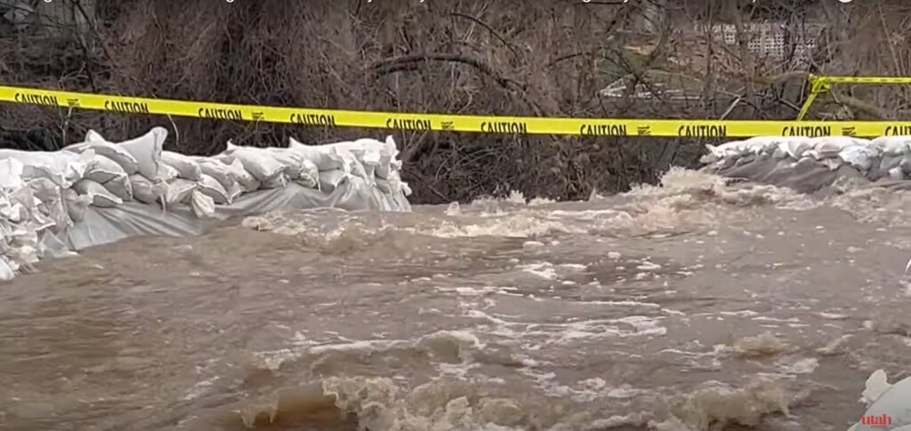
On Tuesday, April 18 of this year, Utah Governor Spencer Cox issued a state of emergency due to the potential for flooding, avalanches, rockslides and mudslides, and granted access to the State’s Disaster Recovery Restricted Account for flood mitigation.
Despite cooler than average April temperatures, rapid snowmelt and subsequent flooding, whether localized or widespread, is inevitable in many areas as the weather warms. Rain accelerated the melting process at lower elevations as snow continued to fall at area ski resorts. So much snow fell in early April that Big and Little Cottonwood Canyon resorts were forced to close temporarily, with Alta reporting a final season total of 903 inches (75 feet) of snow, which is 400 inches more than normal.
By mid-April, dozens of east bench residents were evacuated due to an overflowing Emigration Creek as neighbors and volunteers pitched in to fill and haul sandbags. In a broader community effort, valley residents are encouraged to “Adopt a Storm Drain” by finding the storm drain nearest to them and keeping it unobstructed. Municipal teams are working around the clock to unclog drainage systems and clear debris from local waterways, and the Utah Division of Emergency Management and UDOT have sent nearly 1.5 million sandbags to other affected localities across the state.
The Governor addressed the situation by declaring a state of emergency based on anticipated flood conditions, allowing flood-affected communities and others to access state or federal emergency resources.
In the Governor’s words, “We’re incredibly grateful for the moisture we’ve received this winter, but the extra rain and hefty snowpack present increasing flood risks as the snow melts. By declaring a state of emergency, the state will be better able to tap into reserve funds to support flood response and mitigation efforts. In short, we’ll be better prepared for what lies ahead this spring.” (governor.utah.gov)

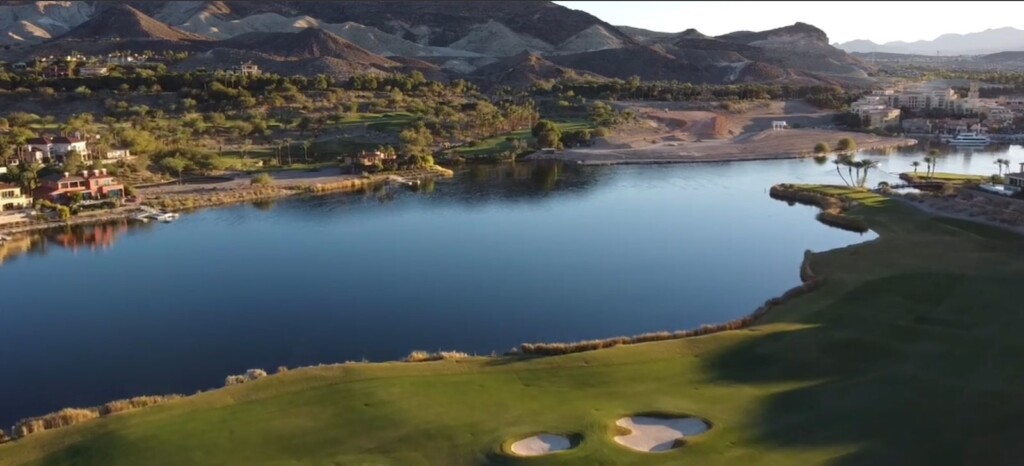
The big question on everyone’s mind is, “What does all this excess water mean for a severely diminished Great Salt Lake?”
Utah’s briny inland sea saw a rise of nearly three feet so far this year, but hydrologists say that a single year of unprecedented snowpack won’t return the thirsty lake to normal levels and that the lake is still in danger of disappearing entirely. This is because much of the water that would naturally flow to the lake will be diverted to fill the state’s reservoirs to satiate excessive consumption, and also because that same amount of water is expected to evaporate from the lake’s large surface area under Utah’s summer sun, returning it once again to dangerously low levels. McInerney believes that the Great Salt Lake will still likely dry up, and he doesn’t believe this weather pattern will persist.
A state assessment concluded that if the lake continues to disappear, economic losses could range from $1.7 billion to $2.2 billion each year, and that toxic dust from the lakebed will become a hazard to human health. Anthropomorphic climate change will continue to decimate the lake, requiring better water conservation measures by residents, and we’ll need many more winters like the last one before the Great Salt Lake can be healthy once again.


