In the spirit of the Appalachian Trail, the Pacific Crest Trail and Continental Divide Trail, Utah’s Jordan River Parkway Trail offers recreation and exploration along the Wasatch Front with a perspective and angle vastly different from more well-traveled roads.

The trail stretches from Utah County through Salt Lake County and into Davis County. From end to end it is a 45-mile stretch that connects with the Legacy Parkway Trail and the Denver/Rio Grande Western Trail in Davis County. A map of the trail shows entry points, access to Trax stations, equestrian areas, dog parks, restrooms, bike routes and wildlife viewing areas.
The map also offers information on things to avoid such as puncturevine, which is as unpleasant as it sounds, and tips on trail etiquette. While out for a ride, the map can help you learn about the flora and fauna of Utah. Some things to watch for include the Great Basin spadefoot toad, the Bullock’s oriole and native bulrush plants along the river.
Trail Specifics
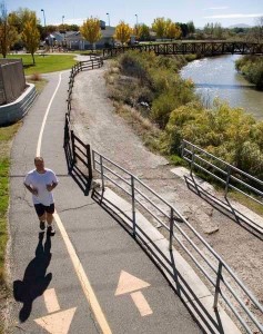
The trail basically follows the river corridor, but does veer off to present changes in scenery. A lot of it goes through wilderness areas. Paths are ten feet wide and paved. There is a two to three percent grade in most areas, but not more than five percent at any point.
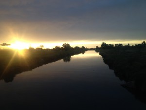
Ambitious bikers can ride from Salt Lake City to Utah Lake at Saratoga Springs away from the distractions and noise of the I-15 corridor. Boanerges Lewis recently biked the Salt Lake portion of the trail. “It’s like riding behind the scenes of the valley. There are things I didn’t know existed here and I was in my own little world right in the middle of the city.” The way navigates the middle road between industrial and wilderness areas that coexist along the Wasatch Front. Freeway underpasses are tagged with graffiti, but the wetlands are full of birds too busy diving and rising in full migration on a swampy, willow-covered meadow to notice. Trailers, broken appliances and chicken coops rest at odd angles in backyards, but the goslings swimming on the Jordan follow their mother single file. Farther along is the Decker Lake Juvenile Detention Center. A young man with a shaved head is jogging inside the fenced-in recreation area while other inmates play basketball. Through a wooded ravine around a bend in the river, the trail reaches South Salt Lake and into Murray. The raised walkways protect marshlands, and more reeds and bulrushes make the area look truly pristine.
Future Plans
Other groups in the valley are working to increase the number of multi-use trails. The Parley’s Rails Trails and Tunnels (PRATT) group is working on a new trail that will connect from the mouth of Parley’s Canyon to the Jordan River Parkway. It will include a feature in Sugar House called The Draw, which runs under 1300 East near 2100 South. The tunnels will allow users to stay on the Parley’s Trails while avoiding riding in heavy traffic.Opening is planned for early June.

Maps of the Jordan River Parkway are available through county recreation centers. The map can also be found at some sporting goods stores and bike shops. More information about the map is available at www.slco.org,where readers can find a downloadable version.
For a recreation experience in your own backyard, find a copy of the map and explore the wonders to be found just down the street.
Story by Connie Lewis


